


Voting District 302, Le Flore County, Oklahoma
About
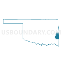
Outline

Summary
| Unique Area Identifier | 654253 |
| Name | Voting District 302 |
| County | Le Flore County |
| State | Oklahoma |
| Area (square miles) | 59.44 |
| Land Area (square miles) | 59.21 |
| Water Area (square miles) | 0.23 |
| % of Land Area | 99.61 |
| % of Water Area | 0.39 |
| Latitude of the Internal Point | 34.68689420 |
| Longtitude of the Internal Point | -94.86533330 |
Maps


Graphs
Select a template below for downloading or customizing gragh for Voting District 302, Le Flore County, Oklahoma


Neighbors
Neighoring Voting District (by Name) Neighboring Voting District on the Map
- Voting District 17, Pushmataha County, OK
- Voting District 215, Le Flore County, OK
- Voting District 301, Le Flore County, OK
- Voting District 303, Le Flore County, OK
- Voting District 304, Le Flore County, OK
- Voting District 305, Le Flore County, OK
Top 10 Neighboring County Subdivision (by Population) Neighboring County Subdivision on the Map
- Heavener CCD, Le Flore County, OK (9,315)
- Wister CCD, Le Flore County, OK (5,153)
- North Pushmataha CCD, Pushmataha County, OK (3,033)
- Talihina CCD, Le Flore County, OK (2,522)
- South Le Flore CCD, Le Flore County, OK (655)
Top 10 Neighboring Place (by Population) Neighboring Place on the Map
Top 10 Neighboring Elementary School District (by Population) Neighboring Elementary School District on the Map
Top 10 Neighboring Unified School District (by Population) Neighboring Unified School District on the Map
- Talihina Public Schools, OK (2,381)
- LeFlore Public Schools, OK (1,689)
- Whitesboro Public Schools, OK (1,188)
Top 10 Neighboring State Legislative District Lower Chamber (by Population) Neighboring State Legislative District Lower Chamber on the Map
Top 10 Neighboring State Legislative District Upper Chamber (by Population) Neighboring State Legislative District Upper Chamber on the Map
Top 10 Neighboring 111th Congressional District (by Population) Neighboring 111th Congressional District on the Map
Top 10 Neighboring Census Tract (by Population) Neighboring Census Tract on the Map
- Census Tract 406.02, Le Flore County, OK (5,387)
- Census Tract 405, Le Flore County, OK (5,153)
- Census Tract 407, Le Flore County, OK (3,177)
- Census Tract 976, Pushmataha County, OK (3,033)